DUNIA TANI INDONESIA

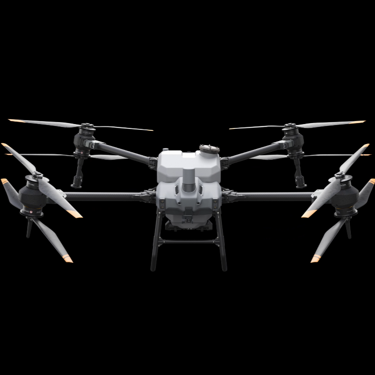
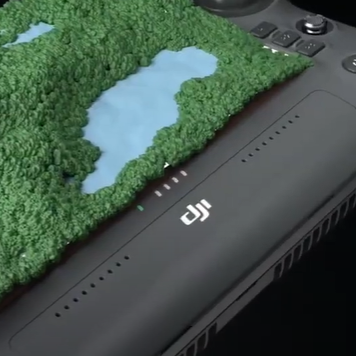
Mapping and Agriculture Drone

Partners

Sinarmas Forestry
SIPEF
LPI
SGC

About Us

PT Dunia Tani Indonesia was previously an individual business established in 2021 by Mr. Heri Faisal who was previously an employee at a National Private Company engaged in Palm Oil Plantations and decided to resign from his job to start a new business in the field of agricultural technology.

And along with the development of the business, in 2023 the business was patented by forming a Limited Liability Company (PT).

With the development of technology in the field of Agriculture, the Company is trying to become one of the service providers that provides the best service to plantation companies and modern farmers in Indonesia.

Our Vision

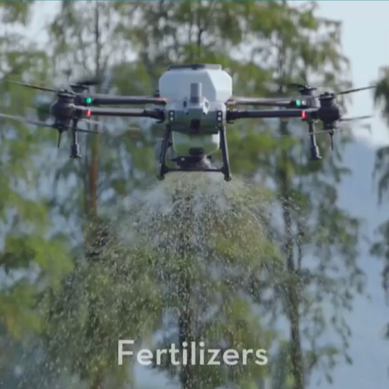
Making a professional organization in the field of aerial photo mapping and agriculture with Drone Sprayer technology in Indonesia.

Extensive benefits for our partners.

Our Mission

We support companies and modern farmers for land mapping and spraying weed, pest and disease control

Support stakeholders to maintain a safe and conducive working environment

PRODUCT ADVANTAGE

...
AUTONOMOUS OPERATION WITH HIGH QUALITY AND EFFICIENCY
  • 20L tank and 7 meter spraying width
  • Double nozzle double atomization with a spray speed of 12 Liters/minute.
  • Operating efficiency 16 Hectares/hour
  • Active Phased Array radar system + Binocular vision
  • Light weight and easy to fold.
...
LARGE TANK CAPACITY FOR EFFICIENT SPREADING
  • 25 Kg spread tank for 7m spread width
  • Spreads 1 ton of fertilizer/hour
  • Has a weighing sensor that can capture the amount of sowing and the amount of material remaining in real time.
  • Washable, Easy to disassemble and Corrosion resistant
...
SMART AGRICULTURE ECOSYSTEM
  • Full “core” remote control map construction
  • Can be integrated with aerial survey and flight defense
  • Equipped with Ultra High Definition camera and adjustable gimbal angle
  • Can create maps locally without the need to network via remote control
  • Can identify boundaries and map obstacles to quickly plan operation routes